Achievements
Central Sulawesi
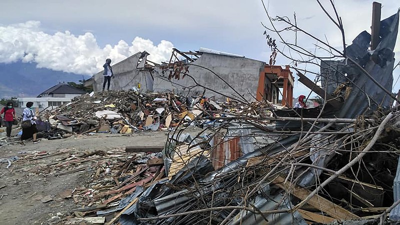
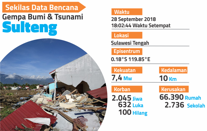
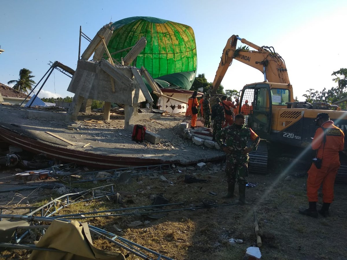
Gempa bumi dan tsunami Sulawesi 2018 adalah peristiwa gempa bumi berkekuatan 7,4 Mw diikuti dengan tsunami yang melanda pantai barat Pulau Sulawesi, Indonesia, bagian utara pada tanggal 28 September 2018, pukul 18.02 WITA. Pusat gempa berada di 26 km utara Donggala dan 80 km barat laut kota Palu dengan kedalaman 10 km. Guncangan gempa bumi dirasakan di Kabupaten Donggala, Kota Palu, Kabupaten Parigi Moutong, Kabupaten Sigi, Kabupaten Poso, Kabupaten Tolitoli, Kabupaten Mamuju bahkan hingga Kota Samarinda, Kota Balikpapan, dan Kota Makassar. Gempa memicu tsunami hingga ketinggian 5 meter di Kota Palu.
Healthcare Facilities
Category : Building Community Resilience ![]()
3 Good Health and Well-Being
2 Public Hospitals
2 Community Health Center
Sanitation Infrastructure
Category : Building Community Resilience ![]()
9 Industry, Innovation, and Infrastructure;
6 Clan Water and Sanitation
Rehabilitation and reconstruction of partially and completely damaged infrastructure for the provision of critical public services
Category : Building Community Resilience ![]()
The UNDP Secretariat and IMDFF-DR are continuing to coordinate and communicate bilaterally at the national level with relevant ministries and international development agencies to ensure zero duplication in targeting reconstruction of facilities. A detailed review of the target list of target facilities has been undertaken, in particular with the Ministry of Public Works and Housing - DG of Work and the Ministry of Health, as well as with the World Bank and ADB. Coordination at the local level has also taken place with the respective Local Government Units in each target district and city. From this synchronization exercise, it was confirmed that the Labuan Induk Pustu in Donggala Regency had been funded from the Donggala Regency budget from the 2019 fiscal year. 15 August 2019. Currently, the target facilities for reconstruction are 28 locations in Central Sulawesi
Disaster Management Planning Documents
Category : Document ![]()
|
|
|
|
|
Rancangan Rencana Induk Sulteng 3012019 |
Pergub Sulteng 10-2019 R3 Paskabencana 12 Apr 2019 |
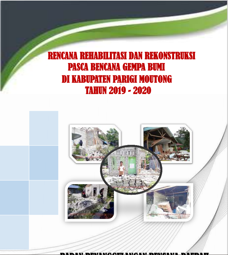
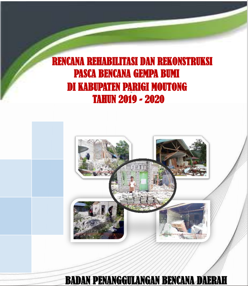
PerBup No 2 Th 2019 Tentang Rencana Rehab Rekon R3 di KAB.PARIGIMOUTONG 2019-2020 |
_12Apr2019 & Lampiran Rinduk.PNG)
|
|
|
|
|
PerBup No 3 Th 2019 tentang Rencana Rehabilitasi dn Rekonstruksi di Kab Sigi 2019-2021 |
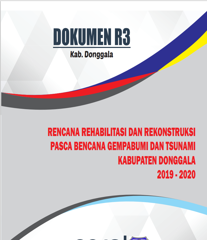
PerBup No 8 Th 2019 tentang Rencana Rehab Rekon di Kab Donggala 2019-2020 |
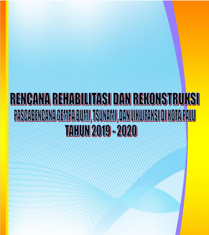
Kep Walkot No 360 Th 2019 tentang RENCANA REHAB REKON KOTA PALU 2019-2020 |
Achievements
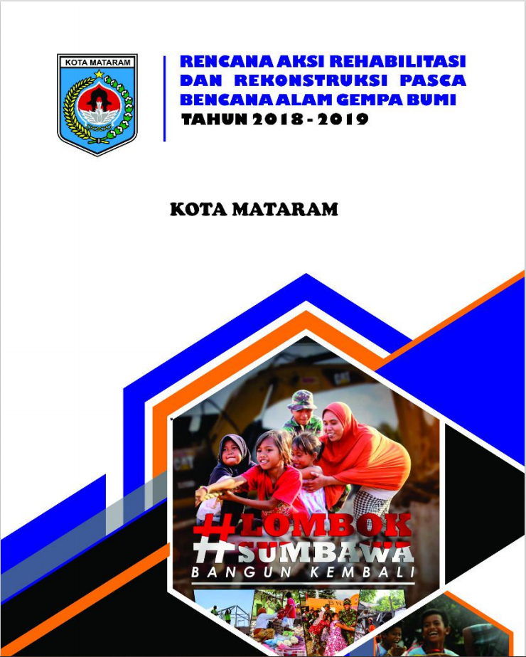
NTB
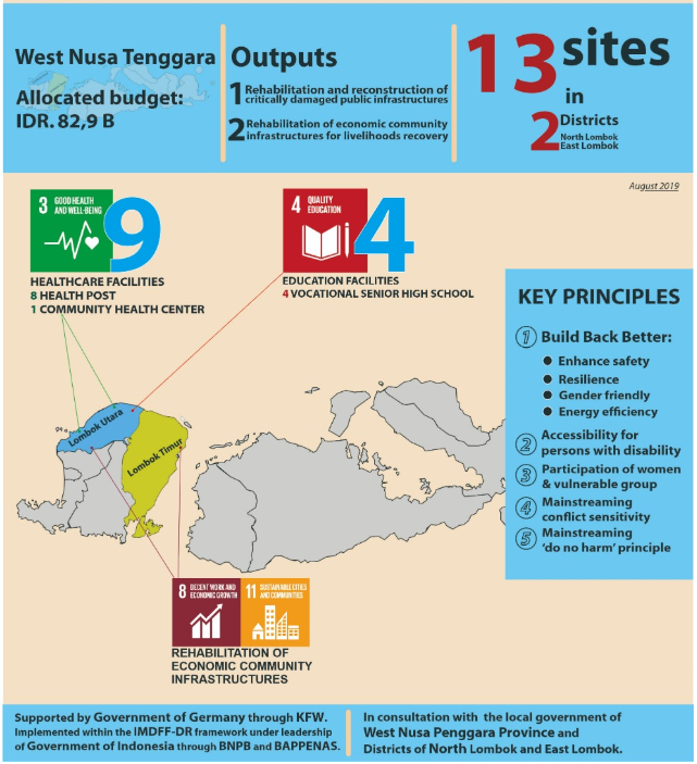
Gempa bumi terjadi pada hari Minggu. tanggal 5 Agustus 2018, pukul 18:45:35 WIB. Berdasarkan informasi dari BMKG pusat gempa bumi berada pada koordinat 8,37° LS dan 116,48° BT, dengan magnitudo 7,0 pada kedalaman 15 km. Sebelumnya, pada tanggal 29 Juli 2018 dengan kekuatan M6,4 dengan kedalaman 10 km.
Gempa bumi ini menimbulkan kerusakan berat di Kabupaten Lombok Utara dan Lombok Timur dan berdasarkan informasi dari BNPB hingga saat korban meninggal dunia akibat gempa ini mencapai 105 jiwa. Badan Geologi mengirimkan Tim Tanggap Darurat Gempa Bumi dan Gerakan Tanah ke lokasi untuk melakukan pemetaan dampak gempa bumi khususnya terkait kerusakan geologi. Tim Tanggap Darurat menemukan retakan tanah dan longsor di jalan yang menghubungkan Kecamatan Pemenang, Tanjung dan Gangga, Kabupaten Lombok Utara. Likuifaksi atau pelulukan juga ditemukan di daerah Gangga. Retakan dan gerakan tanah juga terjadi di Kecamatan Sambelia dan Kecamatan Sembalun, Kabupaten Lombok Timur khususnya di lereng dan sekitar jalur pendakian Gunungapi Rinjani serta perbukitan terjal lainnya. Retakan dan gerakan tanah tersebut dipicu oleh gempa bumi 29 Juli 2018, yang kemudian diperparah oleh guncangan gempa bumi 5 Agustus 2018.
Healthcare Facilities
Category : Building Community Resilience ![]()
Quality Education
Category : Capacity Building ![]()
Disaster Management Planning Documents
Category : Document ![]()
|
|
|
| Pergub NTB No 35 Tahun 2018 Penetapan Renaksi Paska Gempa |
RENAKSI KAB LOMBOK BARAT 30 OKTOBER 2018 |
RENAKSI KAB LOMBOK TENGAH 30 OKTOBER 2018 |
|
|
|
|
|
RENAKSI KAB LOMBOK TIMUR 30 OKTOBER 2018 |
RENAKSI KAB LOMBOK UTARA 30 OKTOBER 2018 |
RENAKSI KAB SUMBAWA BARAT 30 OKTOBER 2018 |

|
|
|
|
|
RENAKSI KAB SUMBAWA 30 OKTOBER 2018 |
RENAKSI KOTA MATARAM 30 OKTOBER 2018 |
[PERUBAHAN] RENAKSI KAB LOMBOK TIMUR Januari 2020 |
Achievements
Kelud

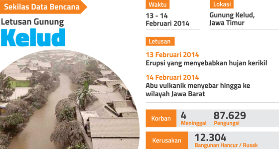
Increased activity of Mount Kelud has been detected since the end of 2013. However, then the situation became quiet again. On February 2nd, 2014, the authority announced the increase of status from "Normal Active" to "Alert". On February 10th, the status was raised to "Standby" and on February 13th, at 9:15 pm, it went to the "Caution" stage.
In less than two hours, at 22:50, the first eruption occurred. Eruption caused gravel rain in Ngancar and Kediri sub-districts, East Java. The sound of explosions was reported to be heard in Surabaya, Solo, Yogyakarta and Purbalingga (about 300 km away from the eruption center).
On February 14th, the impact of volcanic ash has reached the Ponorogo County. In Yogyakarta, the whole area was covered with heavy volcanic ash, even exceeding the volcanic ash from the eruption of Mount Merapi in 2010. The thickness of the volcanic ash in Yogyakarta and Sleman area was estimated more than 2 centimeters.
On February 15th, volcanic ash has reached the district of Kebumen with a thickness of up to 3 cm. The ash rain in Kebumen was followed by rain, resulting in mud rain. It was reported that volcanic ash also reached the area of Ciamis district, the city of Bandung and several other areas in West Java.
Banana Cultivation Development Program
Category : Livelihoods Recovery ![]()
The Owl Breeding Program
Category : Building Community Resilience ![]()
MIS / GIS Software Development Program in High Risk Village
Category : Livelihoods Recovery ![]()
Achievements
Merapi


Balai Penyelidikan and Pengembangan Teknologi Kegunungapian (The Volcanoes Research and Technology Development Agency or BPPTK) in Yogyakarta has recommended to increase Mount Merapi status from "Normal Active" to "Alert" on September 20th, 2010. The first eruption of Mount Merapi occurred on October 26th at around 17:02 pm. At least there were three eruptions that erupted volcanic material as high as approximately 1.5 km and accompanied by the release of hot clouds.
Starting October 28th, Mount Merapi spewed lava incense that appears almost simultaneously with the release of hot clouds. Since November 3rd, there has been an increase in lava and hot cloud activity. On November 4th morning, a major eruption resulted in cloud columns as high as 4 km and bursts of hot clouds to various areas at the foot of Mount Merapi.
Furthermore, since about three o'clock in the afternoon, there were a continuous eruption until night and reach its peak in the early hours of November 5th, 2010. Pebble and sand reach the northern city of Yogyakarta, while heavy volcanic ash rain struck until Purwokerto and Cilacap in Central Java. In the afternoon, volcanic ash is known to have reached Tasikmalaya, Bandung, and Bogor in West Java.
According to data from the National Disaster Management Agency (BNPB) on November 18th, 2010, the death toll reaches 275 people.
Program Bantuan Sapi Potong & Kandang Komunal
Category : Livelihoods Recovery ![]()
Buyer Program Forum for Snake Fruit Farmers
Category : Livelihoods Recovery ![]()
Village Information System Programme
Category : Strengthtening Coordination ![]()
Disaster Management Planning Documents
Category : Document ![]()
|
|
||
|
Dokumen Renaksi
|
Achievements
Sinabung


Since 2010 until now, Mount Sinabung in North Sumatra has been active and has experienced several eruptions. At the biggest eruption, nearly 30,000 people were displaced.
Currently, 1,873 families previously living in unsafe zones have been relocated to safer locations. Meanwhile, 1,080 families are still living at the refugee camps and are waiting to be moved to a new residence.
Mount Sinabung has not been active since the 17th century. However, in 2010, it was suddenly active again, until now. Big eruptions have been occurred in 2010, 2013-2014, 2016, and in February 2018.
In 2010, one person died from respiratory problems while evacuating from his home. In 2014, 14 people founded dead and 3 people injured by hot clouds glide.
The eruption in 2016 claimed as many as 7 people died and 2 others burned. At the last eruption, in 2018, there was no death reported.
Community Based Housing Reconstruction Program
Achievements
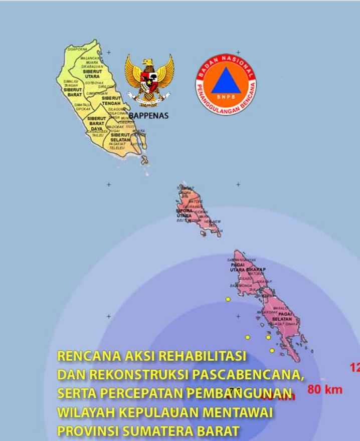
Mentawai
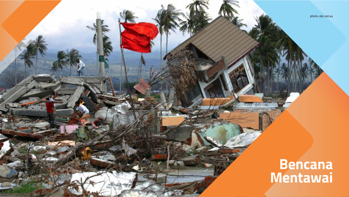

The earthquake and tsunami in the Mentawai Islands, West Sumatra, occurred on October 25th, 2010. The United States Geological Survey (USGS) declared a 7.7 Richter scale earthquake occurred at 21:42:22 local time, at a position of about 240 km west from the Bengkulu Province, close to the Mentawai Islands. Earthquakes are reported to occur at a depth of 206 km below sea level.
The Meteorology, Climatology and Geophysics Agency (BMKG) immediately issued a tsunami warning. However, the warning was later revoked after a possible tsunami threat passed. After the warning was lifted, tsunami waves as high as 3-10 meters struck the Mentawai Islands and destroyed at least 77 villages.
It was reported that 286 people died, 252 people missing and about 200 people suffered injuries, both heavy and light. Because the location of the disaster is relatively remote and can only be reached by ship, report of victims was delayed.
Reported damaged facilities included 15 school units, 10 churches, and 10 bridges.
Cocoa Cultivation Development Program
Category : Livelihoods Recovery ![]()
Local Trainer Capacity Building Program
Category : Livelihoods Recovery ![]()
Program Pelatihan Usaha Makanan Ringan
Category : Livelihoods Recovery ![]()
Disaster Management Planning Documents
Category : Document ![]()
|
|
||
|
Dokumen Renaksi Bencana Mentawai |